Grade 4
Earth and Space Sciences
Chapter 3: Earth and Space Sciences
Lesson 1: The Earth Lesson 2: The Moving Crust Lesson 3: Weathering and Erosion Lesson 4: Changes Caused By the WeatherLesson 1: The Earth
Viwed from space, you can observe many natural features on the earth's surface. These features are called landforms. The tallest landforms are mountains. Valleys are low lying areas between mountains. Plains are mostly flat areas lacking hills or valleys.
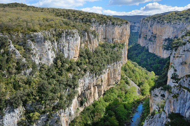
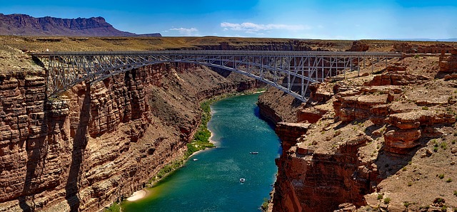
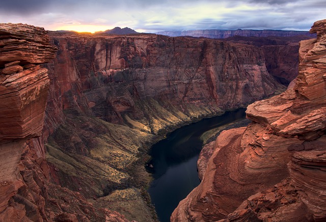
Some landforms are shaped by the flow of water. Water creates small channels or larger gullies and even heavier flow of water over a long period can create valleys. V-shaped valleys are called Canyons and tend to be deep. The Grand Canyon is over 1km deep.

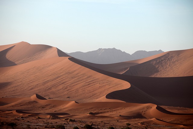
Wind can also result in landforms when it carries and deposits sand in different places, such as sand dunes.

River Delta: When a river nears an ocean and the land is more flat, the spead of the flow of water reduces and drops off bits of sand and soil. This region is called a delta.
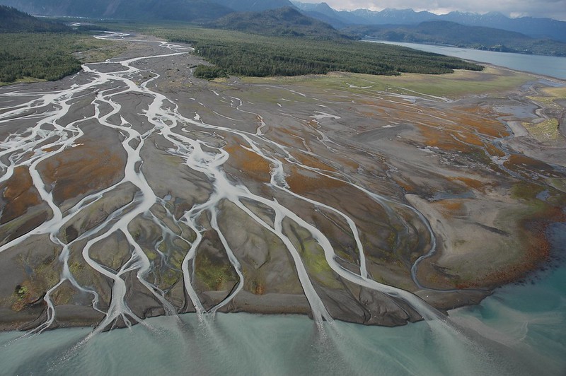
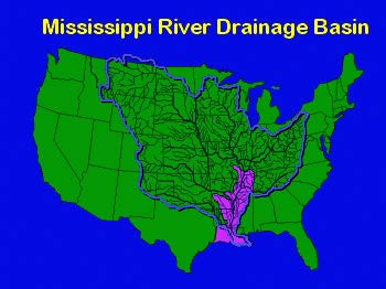
Drainage Basin: Some rivers empty into channels. A drainage basin is the area of land drained by flowing water. The image here shows the drainage basin for the Mississipi River in USA.
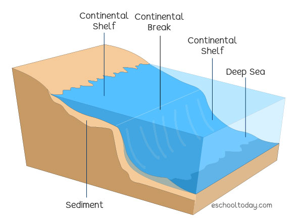
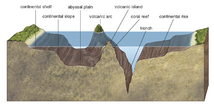
Continental shelf: is the land conecting the shore of the ocean to the sea. Past the continental shelf is an area called continental slope. This is the steeper part of the continent that slopes towards the ocean floor.
Most of the ocean floor is flat and without features. Long mountain ranges, though, stretch through the middles of some oceans. These are ocean ridges. The ocean floor is spotted with undersea volcanoes, too. Deep trenches can cut far into the ocean floor.
Here is an animation of a volcanic eruption in the ocean.
Earth's Interior
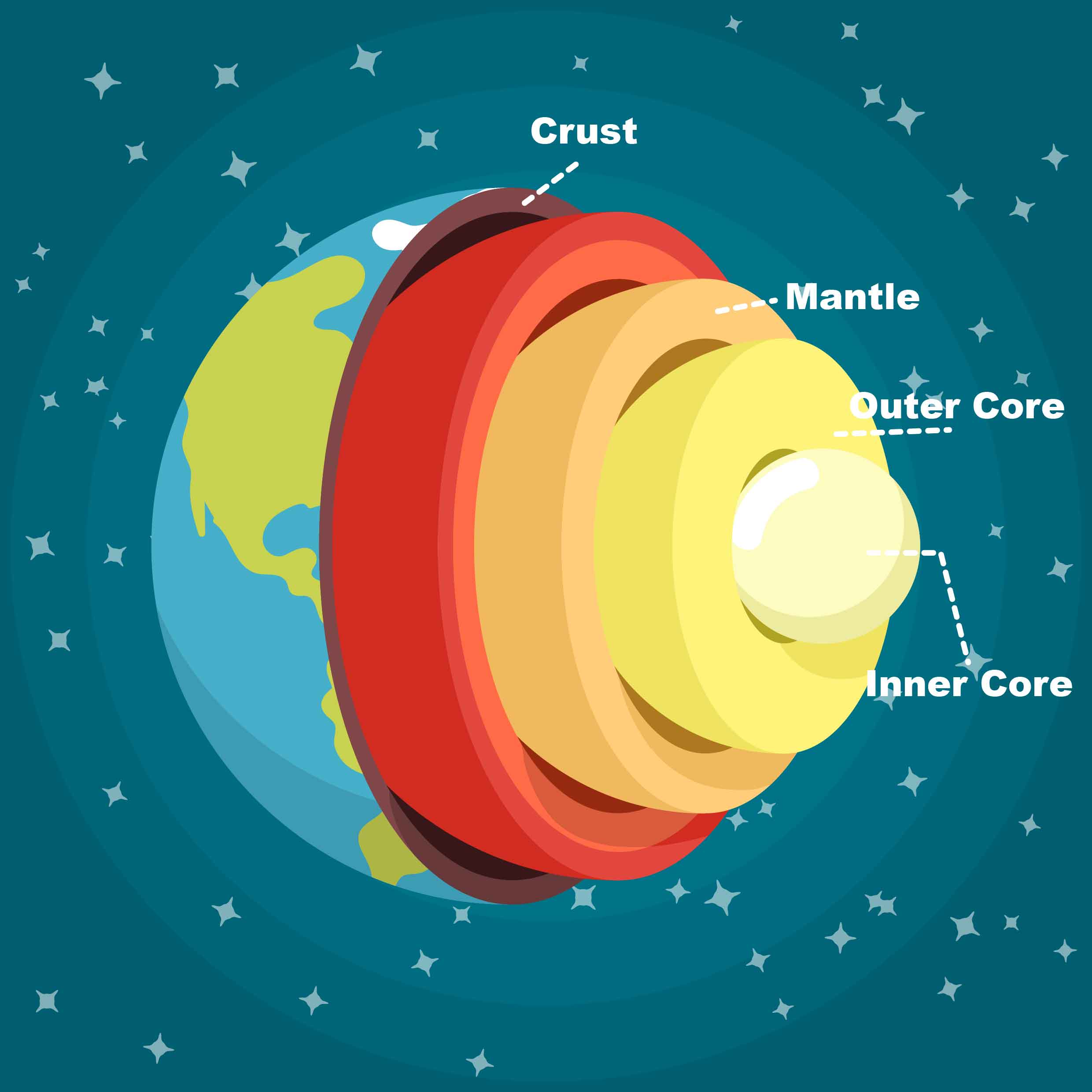
The earth's interior is made up of 4 main layers as follows:
- Crust: the solid rock that makes up the earth's outermost layer. It is brittle and can crack easily. The earth's landforms are found on the crust.
- Mantle: Layer of rock below the crust. It is solid but some of the rock can move or change shape at high pressure or temperature.
- Outer Core: Is liquid layer below the mantle. It is mostly made up of molten iron.
- Inner Core: It is the earth;'s center. It is the hottest part of the earth but it is solid.
Lesson 2: The Moving Crust
The earth is made up of large plates of rock. These plates are made of the crust layer of the earth. When the mantle flows, the plates move. The movement of the plates happens slowly so we cannot feel the actual movement, but the effects of this movement are huge.
Faults: Some plates slide past each other from side to side. The place where they rub is called a fault. A fault is a long, narrow crack in the crust. A plate on one side of a fault can slide up while the other slips down. Rising plates can form faultblock mountains. If the lifting is spread over a wide area, a plateau may form. A plateau is a high landform with a flat top.
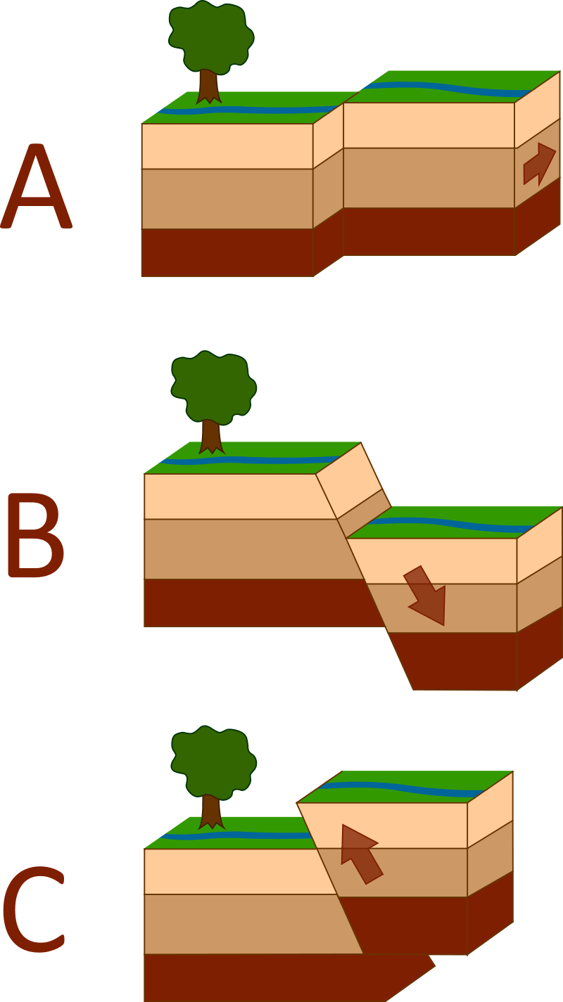
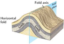
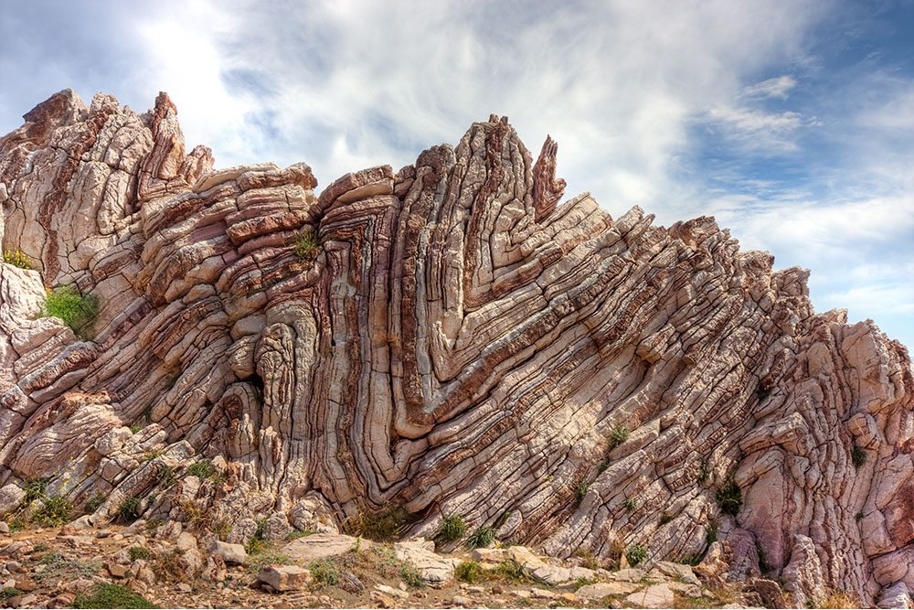
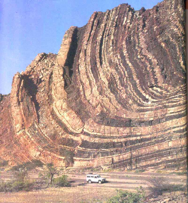
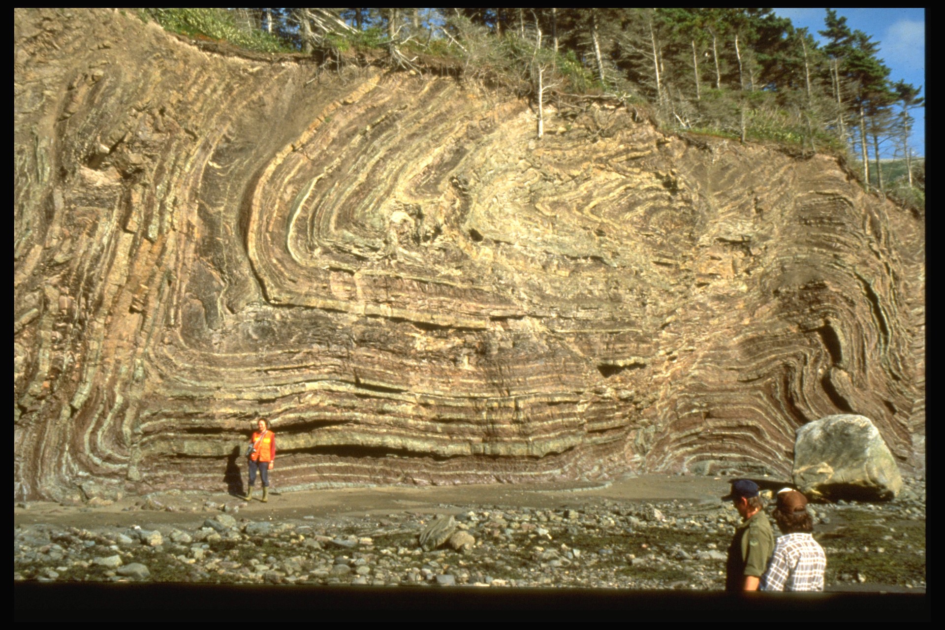
Folds: Some plates meet at the edges of continents. If the land scrunches up between them, a fold forms. A fold is a bend in the rock layers. If the land keeps scrunching, a fold becomes a mountain. A mountain is a tall landform that rises to a peak. As time passes, wind and rain can break off bits and pieces.
Earthquakes: An earthquake is a sudden shaking of Earth's crust. It is caused by plates moving along a fault. When the plates slide against each other, energy builds up in the rock. Earthquakes are common in places with active faults, like parts of Alaska and California. An earthquake starts below the ground and the sudden plate motion shakes the crust. The vibrations move through the crust in all directions.
When earthquakes occur in the ocean the effect depends on how severe the quake was, it might range from a simple increase in ocean waves to a more devastating Tsunami.
Any movement of the plates can cause a vibration. Seismic waves are the vibrations caused by earthquakes. Scientists measure seismic waves with an instrument called a seismograph. It shows seismic waves as curvy lines along a graph. The lines show how much the ground shakes. The stronger.
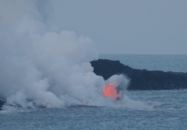
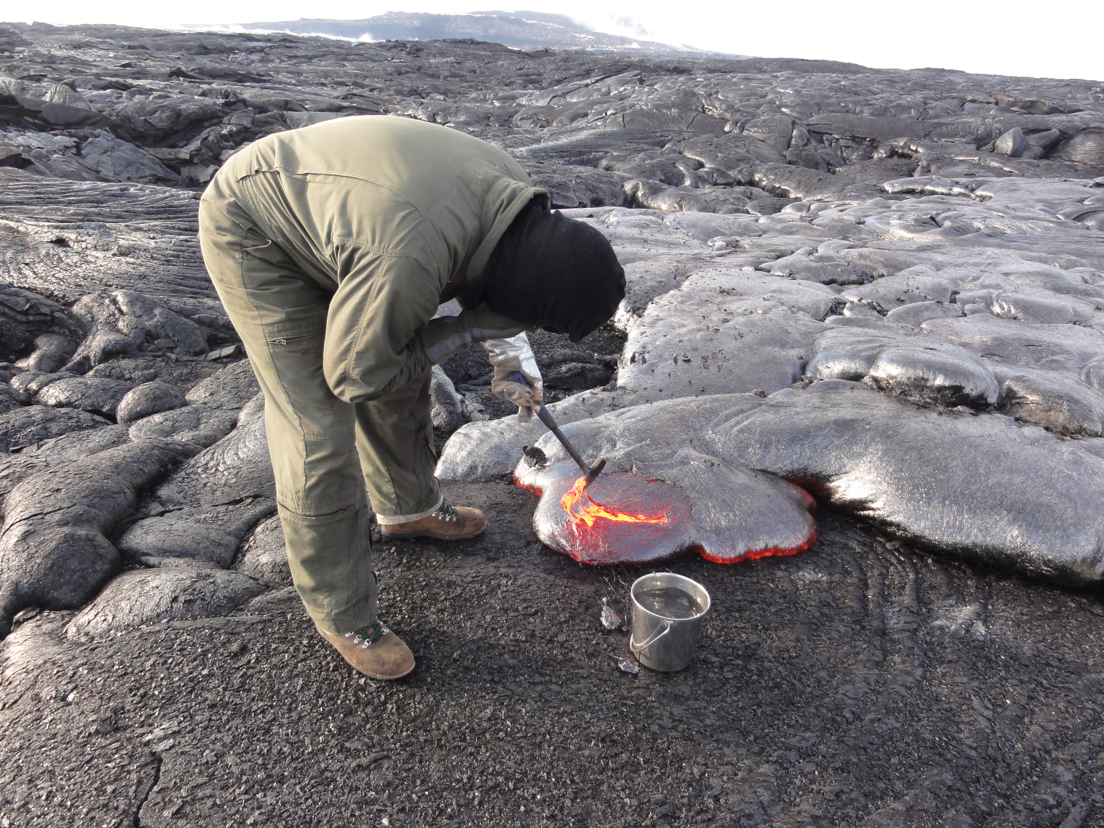
Volcano: A volcano is a mountain that builds up around an opening in Earth’s crust. Sometimes a volcano will force materials from Earth’s interior out of its opening. Scientists call this event an eruption. A volcanic eruption can send out melted rock, gases, ash, or small rocks into the air. Melted rock is called magma. Once magma reaches Earth’s surface, it is called lava. By erupting often, a volcano can build a large mountain. Each eruption adds a layer of lava and ash. The lava and ash cool and harden into rock.
Most volcanoes occur at the edge of the plates where two plates can meet and one plate may sink below the other. at this site, the rock melts into magma and the magma rises to form a volcano.
Volcanoes can also occur far from the edge of the plates, especially if the earth's crust is think. The pressure in the mantle may force the magma to break through the surface.
Lesson 3: Weathering and Erosion
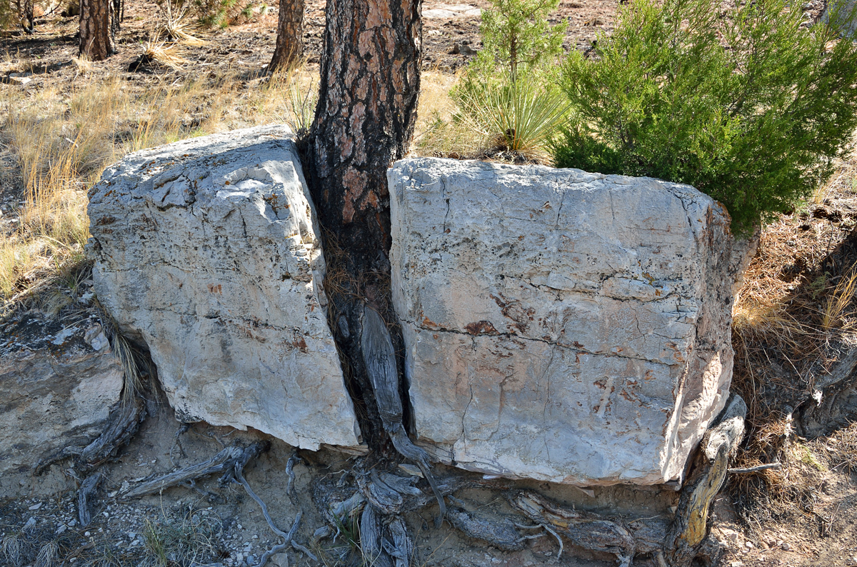
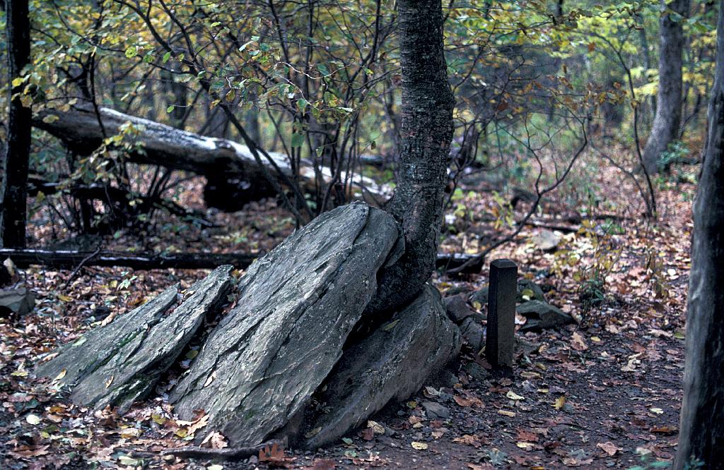
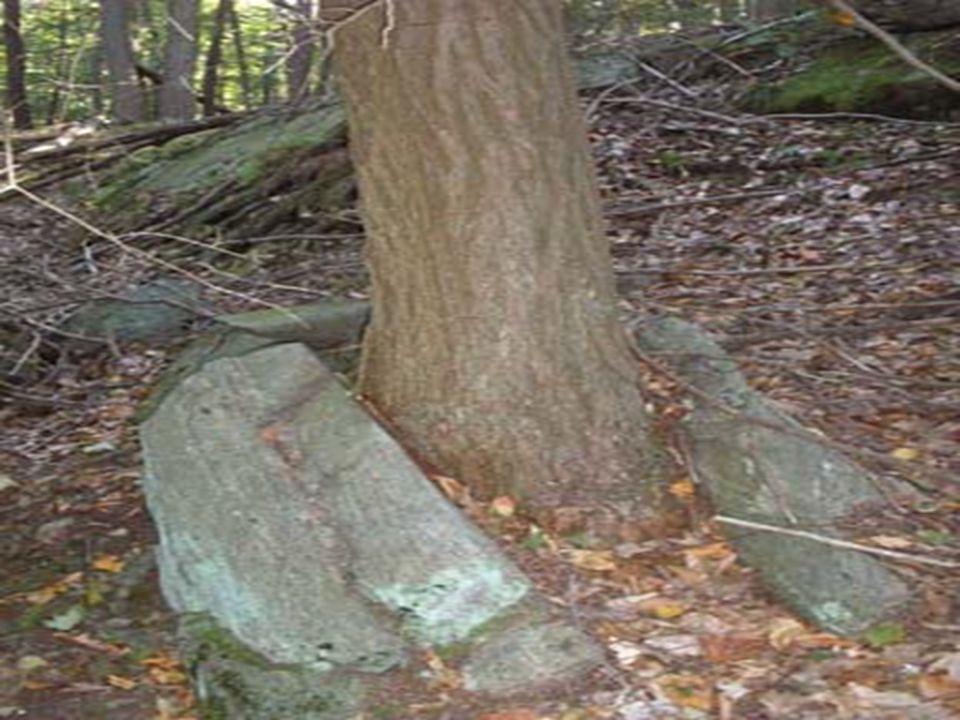
Remember that weathering is the slow process that results in the breakdown of rocks into smaller pieces. Flowing water, rain and wind can all cause weathering.
When weathering takes place without any change in the chemical makeup of the rocks, this is called physical weathering. For example, cycles of freezing and melting results in water expanding (ice) and contracting (during melting) and this can cause rocks to crack, or can widen existing cracks. Plants can cause physical weathering when their roots squeeze through cracks in rocks.
Chemical Weathering changes the mineral composition of the rocks. Oxygen, acids and carbon dioxide can all cause chemical weathering. Water can dissolve soluble minerals from rocks and cause the rocks to fall apart.
Biological weathering is another type of weathering where living things cause the weathering. As you can tell, this classification can also fit under physical or chemical weathering.
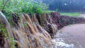
Erosion is the transport of weathered rocks or soil from one location to another.
Erosion can be caused by flowing water, rainfall, waves, wind and gravity.
Deposition is the dropping off of weathered rock, Deposition by water such as a river results in formation of river deltas, beaches etc. Deposition by wind results in sand dunes.
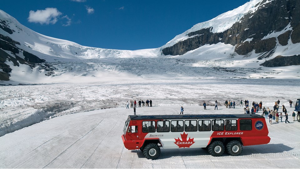
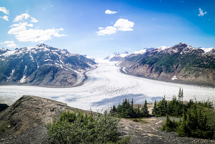
Glaciers: A glacier is a thich sheet of ice that creeps over land. Glaciers form where snow collects quickly and melts slowly. Year after year, the snow builds higher. The weight on top of the mound puts pressure on the snow below. The bottom of the glacier slowly turns to ice. Melting makes the bottom of the glacier slippery. It begins to flow downhill. The bottom and sides freeze onto rocks. As the glacier continues to move, it tears rocks from the ground. It scratches, flattens, breaks, or carries away the things in its path. A glacier can make a valley wider and steeper. Glacial debris can be made of large boulders or small rocks. They can have bits of gravel, sand, soil, and clay. The glacier drops most of this debris at its downhill end, or terminus. Materials that a glacier picks up or pushes can forms mounds. These mounds are called moraines. Today, you can find glacial till and moraines across Canada and northern parts of the United States.
Human Activities: People shape the land through various activities such as mining, deforestation, garbage/waste disposal. These activites may make it easier for other processes to occur. For example, deforestation makes wind erosion easier to happen because once the trees have been removed, the soil is exposed and no longer protected and it can be eroded more easily.
Lesson 4: Changes Caused By the Weather
Weather can change quickly and can cause quick changes to the land. Most of these changes tend to be devastating, because most of the weather changes are extreme and the land and people are usually not well prepared for these events.
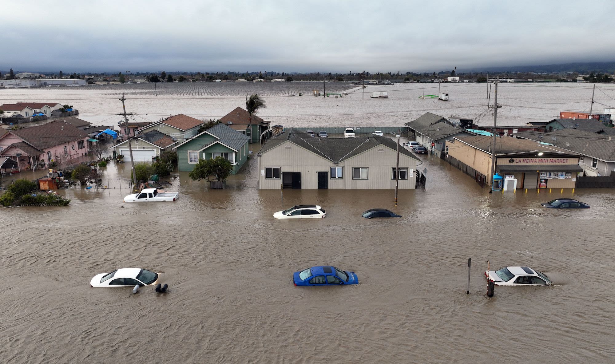
- Floods: Heavy rains or quickly melting snow results in accummulation of water in rivers or on land and the extra water may spill over over river banks. A flood is an overflow of water onto an area on land that is usually dry. Cities can flood can the drainage system is not fast enough to drain the water like would happen during heavy rains. Floods can cause soil erosion, can wash away trees and can deposit mud into homes and streets.
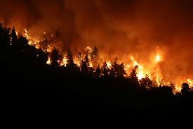
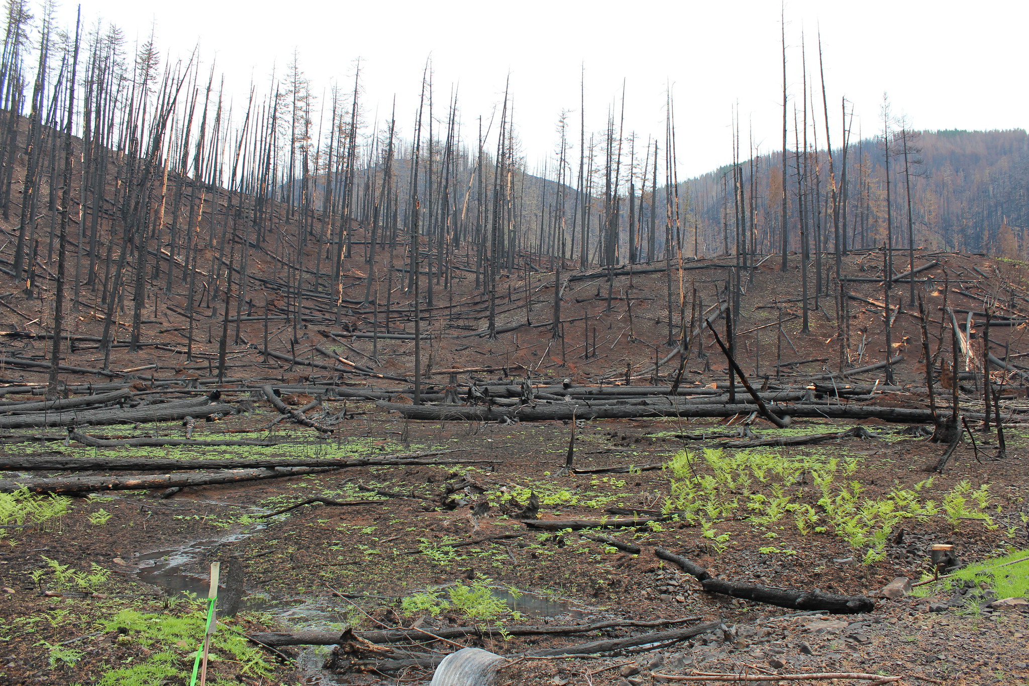
- Fires: Wildfires occur frequently in many parts of the world, espcailly during the hot summer seasons. Wild fires may be caused by lightning, but others can be caused by human activities. Most places recover after wild fires and new vegetation grows again.
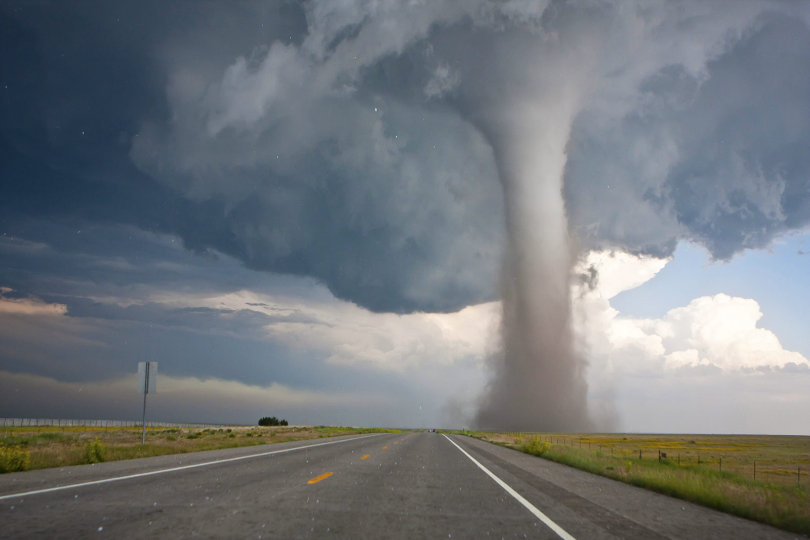
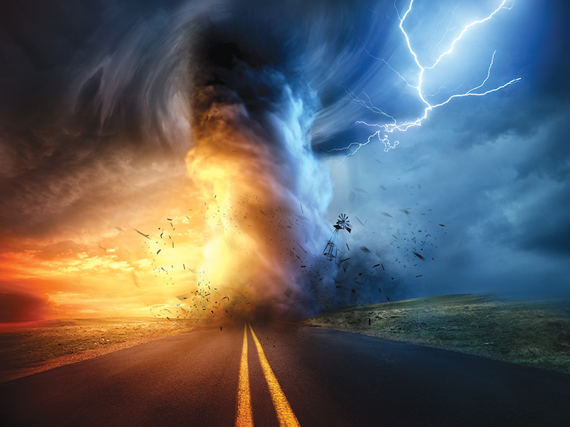
- Tornadoes: Tornadoes are columns of spinning wind that move on land and destroy everything in their path.
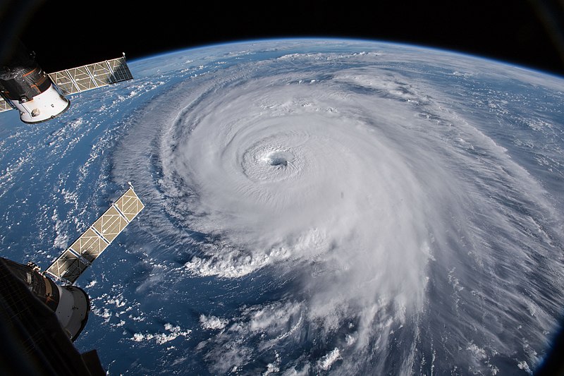
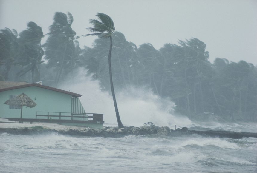
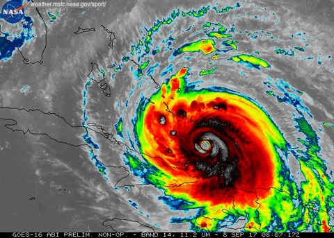
- Hurricanes: hurricanes are large swirling storms. Strong winds, walls of clouds and heavy rains surround the center of the hurricane.hurricanes are usually much larger than tornadoes and can span hundreds of kilometers. When a hurricane moves toward a coast, massive floods can occur. Heavy rains cause flooding, and a hurricane can uproot trees and flatten buildings. Hurricanes can cause significant devastation and can change an entire ecosystems very fast.
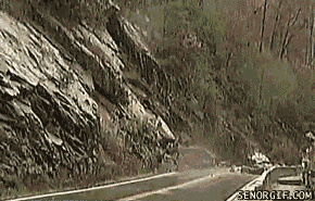
- Landslide: A landslide is sudden movement of large amounts of material downhill enhanced by gravity. The material may include rocks, soil, trees and grasses etc. An Avalanche is a similar movement but of ice and snow down a mountain.
Chapter 4: Weather and Climate
Lesson 1: Air and Weather Lesson 2: The Water Cycle Lesson 3: Tracking The Weather Lesson 4: ClimateLesson 1: Air and Weather
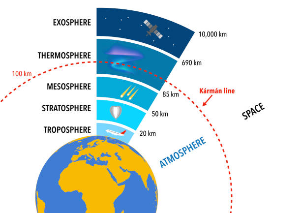
Air is a mixture of gases that surrond the earth like a blanket. This layer is called the Atmosphere
The air on earth consists of three main gases, Oxygen, Nitrogen, Carbon dioxide and water vapor. Without these gases, there would be no life on earth.
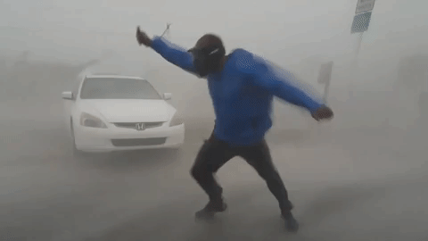
Air that moves from place to place is called Wind. wind can be gentle and can also be strong and destructive.
The earth's atmosphere is made up of several layers. The layer closest to the earth surface is called the Troposphere. This is a thin layer but all of life lives in this layer. The Stratosphere is located above the troposphere. Temperatures here are a bit warmer than the troposphere.
Properties of Weather Weather is the condition of the atmosphere at an given time and place. Some of the properties of weather include:
- Temperature: describes how hot or cold it is. When the suns energy hits the ground, the surface warms the air above it and the air temperature increases. A thermometer is used to measure temperature.
- Humidity: is a measure of how much water vapor is in the air. Deserts have low humidity while rain forests have high humidity. Areas close to an ocean or large lakes also have high humidity due to evaporation from the ocean. Humidity is measured using a hygrometer.
- Air pressure: Air pressure is the force that air pushes on the surface of the earth. Air pressure is measured by an equipment called Barometer.
- Precipitation: Any form of water that falls from clouds is called precipitation. This includes rain, snow, sleet and hail. A rain gauge is used to measure the amount of rainfall.
- Wind: Wind is air in motion. The wind speed if an important property of weather. It can influence how cold it feels (wind chill). It can result in faster evaporation of water from oceans and lakes. The direction of wind is measured using a wind vane and the speed of wind can be measured using an Anemometer.
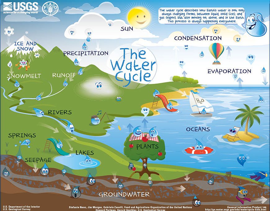
Lesson 2: The Water Cycle
The water cycle is made up of three manin processes.
- Evaporation
- Condensation
- Precipitation
Evaporation
When water heats up, some of it changes into a gas called water vapor. This process is called evaporation.
Water evaporates from lakes, oceans, rivers, ponds and other water bodies.
Water can also evaporate from the surface of leaves in a process called transpiration.
Condensation
The water vapor travels in the air. As it rises into the air, it cools down and turns back into a liquid. The change from gas to liquid is called Condensation.. If many water droplets in the sky come together they form clouds. A cloud is a group of water droplets in the atmosphere.
Precipitation
The water in the clouds and the water vapor in the air will then fall down to the ground as rain or other kids of precipitation.
Precipitation refers to any liquid or frozen water that forms in the atmosphere and falls back to the earth. It comes in many forms, like rain, sleet, and snow.
If its too cold, the water droplets in clouds will freeze into ice. Freezing refers to the change from liquid to solid.
When it rains, water flows on the surface of the earth as runoff. Runoff gathers in rivers, lakes and oceans.
Clouds
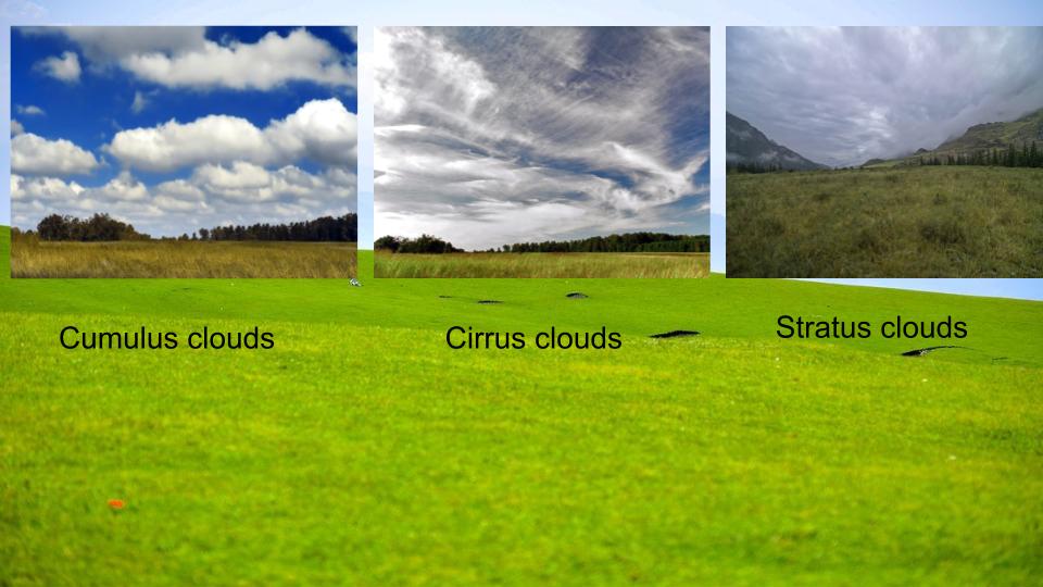
There are different kinds of clouds and each type means a different type of weather may be coming.
Cumulus clouds are small, white puffs. They may also appear in long rows.
Cirrus clouds are thin clouds very high in the sky. They are made of ice.
Stratus clouds are often low in the sky. They come in sheets and cover the entire sky.
You may have seen clouds grow dark before a rainstorm. If a cumulus cloud becomes dark and thick, it is called a cumulonimbus cloud. This type of cloud can result in precipitation.
Snow
Water freezes at 0°C. When it is cold in the atmosphere and the water vapor freezes and becomes heavy, they fall as snow. The snow may melt as it falls on the ground. Melting means changing from solid (ice) to liquid (water).
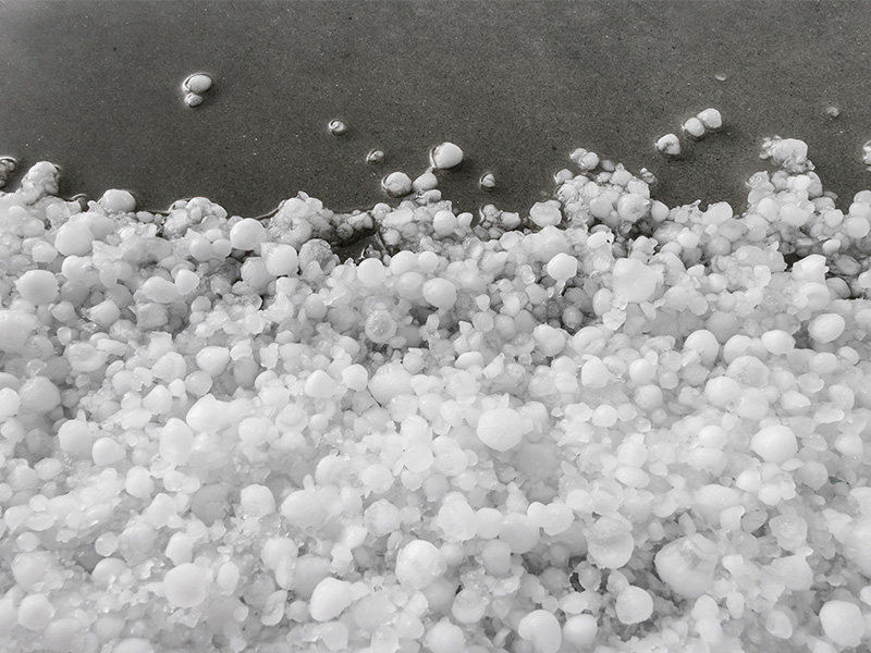
Hail
When rain falls as a liquid but freezes along the way, it turns into small chunks of ice called sleet. When these chunks of ice are larger, they are called hail. Usually, hail occurs together with a thunderstorm. Hail ranges form the size of a pea to large chunks the size of a baseball.
Lesson 3: Tracking The Weather
Some parts of Hawaii, India and Africa receive the highest rainfall in the world. However, other parts of Africa and South America are among the driest places on earth. The Atacama desert in South America is the driest place on earth. Several other deserts exist in North America, Africa and Asia. How can we explain the differences in the amount of precipitation?
Air Masses: An air mass is a region or an area where the air has the same properties. The weather in these regions is also the same and the air mass behaves as one unit. Air masses usually form at the poles of the equator and move across the earth covering it like a blanket.
As air masses move, they bring weather along with them. When two air masses meet, the area where they meet is called a front. A front, therefore, is the boundary between two air masses that have different temperatures. Because of the temperature difference, fronts result in a change of weather where they occur.
When a warm air mass meets a cold air mass, a warm front forms. The warm air moves up above the cold air and layers of clouds are formed. A warm front usually causes light steady rain.
When a cold air mass pushes under a warm air mass, thick clouds form as the warm air rises and cools. This results in stormy weather.
A stationary front occurs when air masses are not moving. This results in rainy weather lasting for several days.
Weather Forecasting
Forecasting is to predict. Weather forecasting attempts to predict how the weather conditions will be at a future date. Scientists use many technologies in forecasting. Satellites in orbit around Earth take pictures of the atmosphere. Computers help scientists analyze weather data and produce better weather maps.
Extreme Weather:
Thunder is the loud sound you hear during a thunderstorm and is made when lightning heats the air around it quickly.
A Tornado is a rotating column of air that touches the ground during a thunderstorm. it can be dangerous so when you see a tornado, or suspect a tornado may be approaching, you need to take cover.
Hurricanes form over warm water in the ocean. They result in heavy rains and strong winds.
If thunderstorms are predicted in the weather, stay away from water and trees. If tornadoes are predicted, stay in a sturdy shelter such as a basement. In any storms, always listen and follow the directions provided by your local authorities.
Lesson 4: Climate
Climate is the pattern of weather that can be observed in a specific place year after year. Different parts of the earth have different climates. Climate can be described using words like warm and dry, cold and snowy, cool and wet, etc. Farmers depend on climate to decide which crop to grow and when to grow. Some crops do well in dry areas and others need a lot more rainfall to grow.
Climate Regions: Climate areas are areas which have similar patterns of temperature, humidity, precipitation and wind. For example, Polar regions tend to be cold, and have low precipitation. Tropical regions lie close to the equator and are warm, humid and rainy. Temperate regions are in between polar and tropical. Temperate regions have four seasons (Summer - Fall - Winter - Spring). Other temperate regions have more like two seasons, a wet and a dry season.
Factors that affect Climate
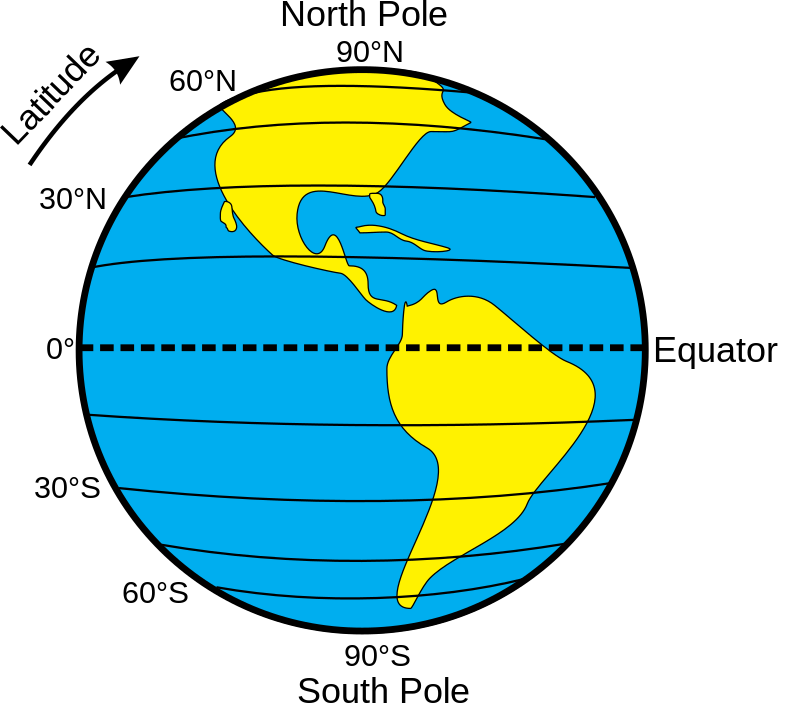
- Latitude: Latitudes are a measure of how far a place is from the equator. The equator's latitude is 0 degrees (0°). The highest latitudes are at the North and South poles. Both are 90°. The climate is very cold at the poles, while the climate is warm and rainy at the equator. The regions between the equator and the poles are temperate and the climates vary but is mostly mild.
- Global Winds: Temperature differences between latitudes cause global winds. These are winds that move air between the equator and poles. Warm air at the equator rises and moves toward the poles. Cold air near the poles sinks and moves toward the equator.
- Ocean Currents: Ocean currents indicate the direction of flow. Some ocean currents may result in movement of warm water from the equator to the poles. There are also currents that move along the latitudes. Togetehr, these currents result in circular patterns in the oceans.
- Distance from water bodies: More than 70% of the earth surface is covered by water. Climates near lakes and oceans are cloudier and rainier than regions farther inland. Summers are cooler. Winters are warmer. Nearness to water reduces temperature extremes. It also increases moisture in the air.
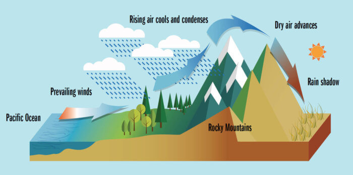
- Altitude: Altitude is a measure of of the height of a place above the sea level. The climate at the base of a mountain is usually warmer than at the peak. Warm air rises up the side of the mountain and as the alititude increases, the temperature reduces. Water vapor in the air condenses to form clouds. As the cloud moves up the side of the mountain, the water droplets become heavy and they fall as precipitation. By the time the air passes to the other side of the mountain, it is dry and cannot cause significant precipitation. so the climate on the other side of the mountain tends to be dry. (Picture credit: Eileen Chontos.)